פרסום פרויקט
 התחבר עם פייסבוק

 1 צפיות
 0 שבחים
Entry content
Entry content
Entry content
Entry content
Entry content
Entry description
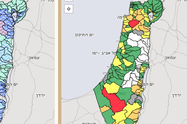
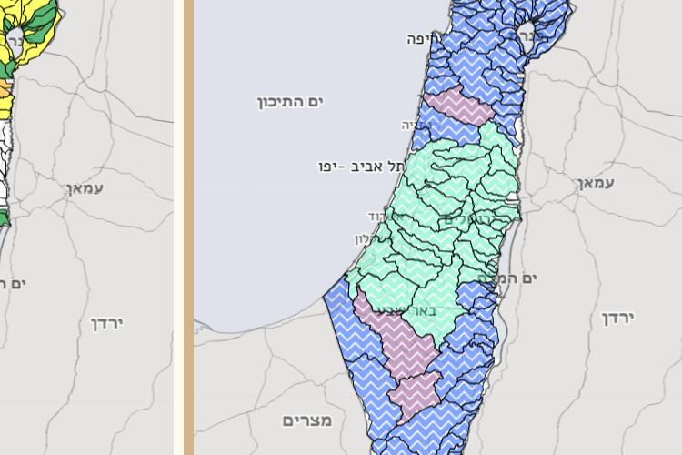
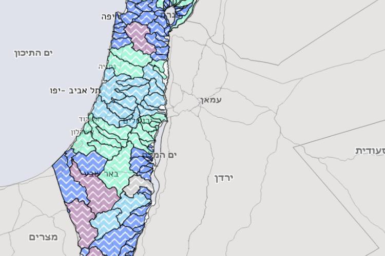
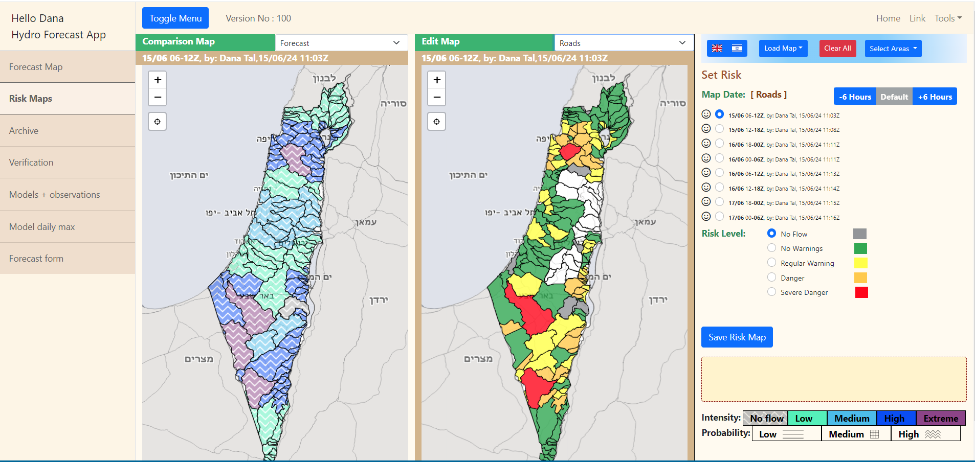
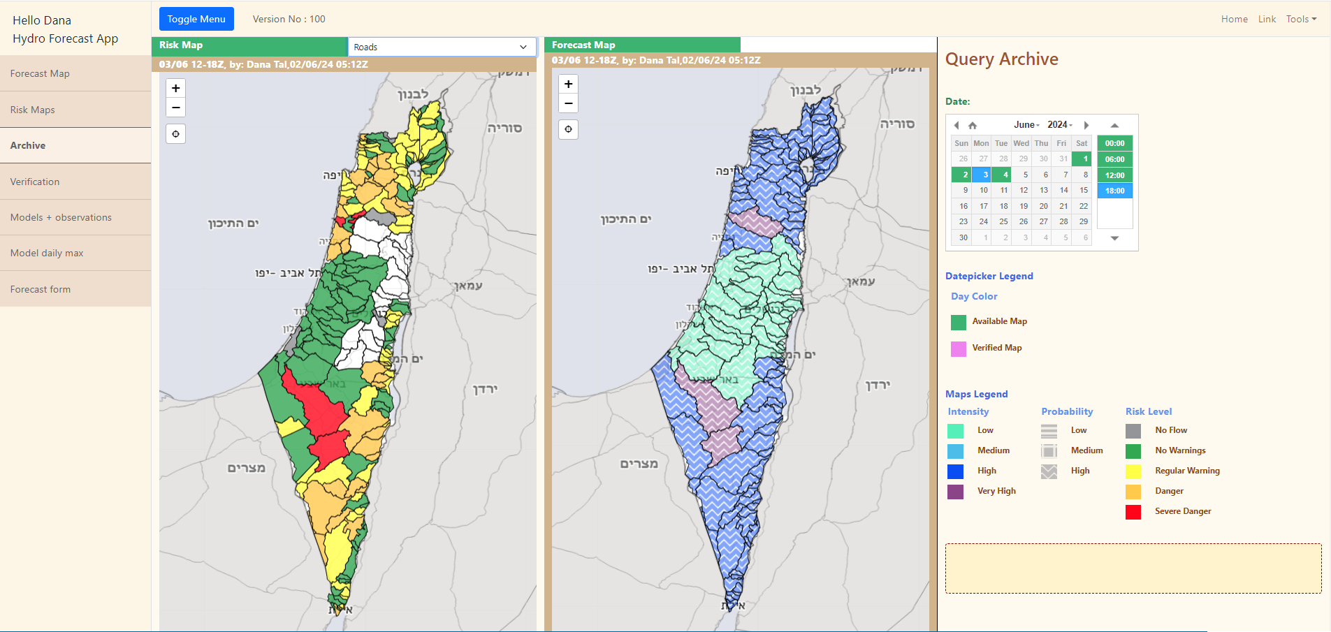
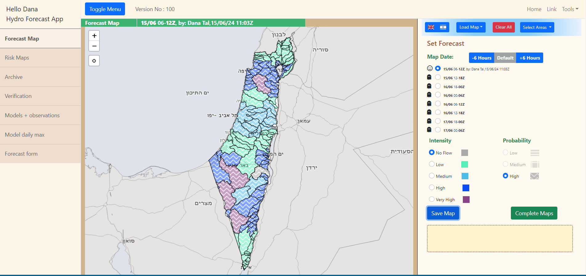
This page enables the water authority forecasters to create rain forecasts on a map. The map is showing geographical areas as polygons. The forecaster can paint the map in different ways. The forecast is expressed as a combination of intensity (stated by color) and probability (stated by a pattern).
הוסף תגובה
0 תגובות
 הוסף תגובה
0 תגובות
הוסף תגובה
0 תגובות
אנא
היכנס למערכת
כדי להגיב